Global Positioning System (GPS) technology has revolutionised modern agriculture, transforming the way farmers operate their machinery and manage their fields. This advanced satellite-based navigation system has become an integral part of precision farming, enabling unprecedented levels of accuracy and efficiency in various agricultural operations. From automated steering systems to variable rate applications, GPS has ushered in a new era of smart farming practices that optimise resource utilisation, increase yields, and reduce environmental impact.
Evolution of GPS integration in agricultural machinery
The integration of GPS technology into agricultural machinery has been a gradual process that has gained significant momentum over the past two decades. Initially, GPS was primarily used for basic field mapping and simple guidance systems. However, as the technology advanced and became more affordable, its applications in agriculture expanded dramatically.
Early GPS systems in agriculture provided accuracy within several metres, which was sufficient for tasks such as field boundary mapping and rough guidance. Today, high-precision GPS receivers can achieve sub-inch accuracy, enabling extremely precise operations such as planting, spraying, and harvesting. This evolution has been driven by advancements in satellite technology, improved receiver designs, and the development of augmentation systems like Real-Time Kinematic (RTK) networks.
The adoption of GPS technology in agriculture has been rapid and widespread. According to recent industry reports, over 80% of new tractors and combines sold in developed countries now come equipped with some form of GPS guidance system. This widespread adoption has led to significant improvements in productivity, with studies showing that GPS-guided machinery can reduce overlap and increase field efficiency by up to 10%.
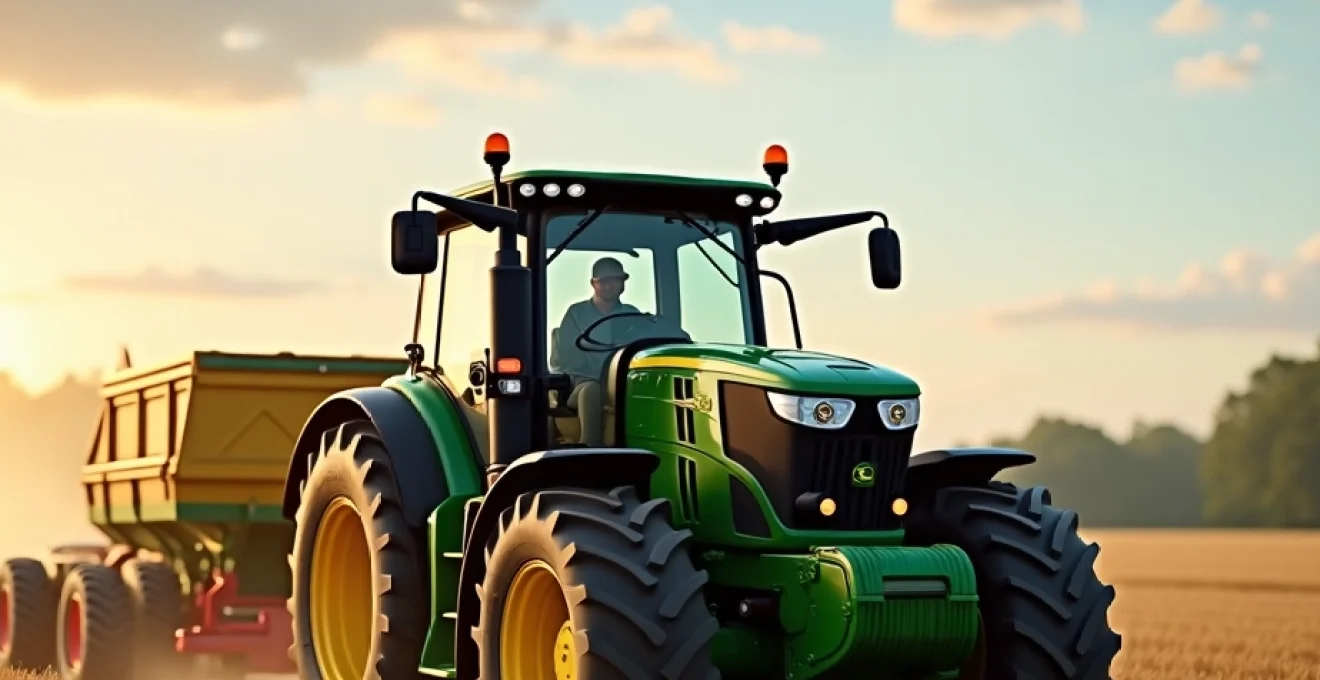
Precision agriculture: GPS-Enabled tractors and harvesters
Precision agriculture represents one of the most significant applications of GPS technology in farming. GPS-enabled tractors and harvesters form the backbone of this approach, allowing farmers to operate their machinery with unprecedented accuracy and consistency. These advanced systems have transformed traditional farming practices, enabling operations that were previously impossible or impractical.
John deere AutoTrac™ system: automated steering precision
John Deere’s AutoTrac™ system is a prime example of how GPS technology has been integrated into agricultural machinery. This automated steering system uses high-precision GPS receivers to guide tractors and other self-propelled equipment along predetermined paths with sub-inch accuracy. The system allows operators to focus on other aspects of the operation, such as monitoring implement performance or adjusting application rates, while the tractor maintains its course automatically.
The AutoTrac™ system has been shown to reduce overlap in field operations by up to 90%, resulting in significant savings in fuel, time, and inputs. Moreover, it enables consistent operation even in low-visibility conditions, such as dust, fog, or darkness, extending the potential working hours and improving overall farm productivity.
Case IH AFS AccuGuide™: Real-Time kinematic (RTK) technology
Case IH’s Advanced Farming Systems (AFS) AccuGuide™ utilises RTK technology to achieve even higher levels of precision. RTK systems use a network of fixed ground-based reference stations to correct GPS signals, providing accuracy levels of up to 2.5 cm. This level of precision is particularly crucial for operations such as strip-tilling, where consistent and accurate placement of seeds and nutrients is essential for optimal crop growth.
The AFS AccuGuide™ system also offers features like automatic headland turning and the ability to follow curved paths, further enhancing operational efficiency and reducing operator fatigue. These advanced capabilities have made RTK-based systems increasingly popular among farmers seeking the highest levels of precision and consistency in their operations.
Trimble agriculture GFX-750™ display: Sub-Inch accuracy
Trimble’s GFX-750™ display system represents the latest in GPS guidance technology for agriculture. This system combines a high-precision GNSS receiver with an intuitive touchscreen display, providing farmers with a powerful tool for precision farming operations. The GFX-750™ can achieve sub-inch accuracy when used with Trimble’s RTK corrections, making it suitable for the most demanding precision agriculture applications.
One of the key advantages of the GFX-750™ system is its compatibility with a wide range of vehicles and implements, allowing farmers to integrate precision guidance across their entire fleet. The system also supports advanced features such as automated section control and variable rate application, further enhancing the efficiency and precision of farming operations.
CLAAS GPS PILOT: parallel tracking and contour management
CLAAS, a leading agricultural machinery manufacturer, offers the GPS PILOT system, which provides advanced guidance capabilities for tractors and harvesters. The system excels in parallel tracking, allowing operators to maintain precise parallel paths across a field, even when working on slopes or irregular terrain. This capability is particularly valuable for operations such as spraying or fertiliser application, where consistent coverage is crucial.
The GPS PILOT system also includes sophisticated contour management features, enabling operators to create and follow complex field patterns. This functionality is especially useful in fields with irregular shapes or obstacles, allowing farmers to optimise their field operations and minimise unproductive time spent manoeuvring equipment.
Variable rate technology (VRT) and GPS mapping
Variable Rate Technology (VRT) represents one of the most significant advancements enabled by GPS in agriculture. VRT allows farmers to apply inputs such as seeds, fertilisers, and pesticides at varying rates across a field, based on soil conditions, crop health, and other factors. This precision approach optimises resource use, reduces waste, and can significantly improve crop yields.
Topcon X35 console: Prescription-Based input application
The Topcon X35 console is a sophisticated VRT system that enables prescription-based application of inputs. Using high-resolution GPS mapping, the X35 can create detailed field maps that account for variations in soil type, nutrient levels, and other factors. These maps are then used to generate application prescriptions, which the system follows automatically during field operations.
For example, a farmer using the X35 system might apply more fertiliser in areas of the field with lower soil fertility, while reducing application rates in more fertile areas. This targeted approach not only optimises input use but can also lead to more uniform crop growth across the field.
Ag leader InCommand™: Multi-Product VRT control
Ag Leader’s InCommand™ system takes VRT to the next level by enabling multi-product control. This advanced system allows farmers to simultaneously vary the application rates of multiple inputs, such as different types of fertilisers or a combination of seeds and fertilisers. The InCommand™ system uses high-precision GPS and detailed field maps to ensure that each product is applied at the optimal rate for each specific area of the field.
The ability to control multiple products independently offers significant advantages in terms of efficiency and precision. For instance, a farmer could simultaneously plant seeds at varying densities while adjusting fertiliser rates to match the specific needs of each area, all in a single pass through the field.
Raven viper® 4+: section control and As-Applied mapping
Raven’s Viper® 4+ system combines VRT capabilities with advanced section control and as-applied mapping. Section control uses GPS to automatically turn off sections of a sprayer or planter when passing over areas that have already been covered, reducing overlap and preventing double application of inputs. This feature is particularly valuable when working in irregularly shaped fields or around obstacles.
The as-applied mapping feature of the Viper® 4+ system creates detailed records of exactly where and at what rate inputs were applied. This information is invaluable for post-season analysis and future planning, allowing farmers to refine their application strategies and improve efficiency over time.
Gps-driven yield monitoring and crop analysis
GPS technology has also revolutionised the way farmers monitor and analyse their crop yields. Modern combine harvesters equipped with GPS and yield monitoring systems can create detailed yield maps as they harvest a field. These maps provide farmers with invaluable insights into the variability of crop performance across their fields.
Yield maps generated by GPS-enabled harvesters show precisely where in a field yields were higher or lower. This information can be correlated with other data, such as soil type, topography, and input application rates, to identify factors affecting crop performance. Farmers can use these insights to make informed decisions about future management practices, such as adjusting fertiliser rates or addressing drainage issues in specific areas.
Moreover, GPS-driven yield monitoring enables farmers to accurately track their total production and analyse trends over time. This data is crucial for financial planning, marketing decisions, and long-term farm management strategies. The ability to quantify and analyse yields with such precision was simply not possible before the advent of GPS technology in agriculture.
Autonomous agricultural vehicles and GPS navigation
The integration of GPS technology with advanced robotics and artificial intelligence is paving the way for autonomous agricultural vehicles. These self-driving machines represent the cutting edge of precision agriculture, promising to further increase efficiency and reduce labour requirements in farming operations.
CNH industrial’s autonomous concept vehicle (ACV)
CNH Industrial, the parent company of Case IH and New Holland, has developed an Autonomous Concept Vehicle (ACV) that showcases the potential of fully autonomous tractors. The ACV uses a combination of GPS, radar, LiDAR, and camera systems to navigate fields and perform various tasks without human intervention. The machine can be programmed to follow pre-planned routes and adjust its operations based on real-time sensor data.
While still in the concept stage, the ACV demonstrates how GPS technology could enable 24/7 farming operations, with machines working autonomously day and night to maximise productivity. This level of automation could be particularly valuable during critical periods such as planting and harvesting, when timing is crucial.
Kubota’s autonomous tractor project
Kubota, a major player in the agricultural machinery market, is also investing heavily in autonomous tractor technology. Their prototype autonomous tractor uses GPS in combination with other sensors to navigate fields and perform tasks such as tilling, planting, and spraying. The system is designed to work in coordination with human operators, who can monitor and control multiple autonomous tractors simultaneously from a central control station.
One of the key advantages of Kubota’s approach is the potential for “swarm farming,” where multiple smaller autonomous tractors work together to complete tasks more efficiently than a single large machine. This approach could offer benefits in terms of soil compaction reduction and operational flexibility.
Agco’s fendt xaver swarm robots
AGCO’s Fendt brand has taken the concept of autonomous farming even further with its Xaver swarm robots. These small, lightweight machines work in groups to plant seeds with high precision. Each robot uses GPS for navigation and can plant seeds individually, adjusting spacing and depth based on soil conditions and predetermined planting maps.
The Xaver system represents a radical departure from traditional large-scale machinery, offering potential benefits in terms of soil health, energy efficiency, and operational flexibility. While still in the development stage, this technology showcases how GPS could enable entirely new approaches to agricultural operations.
Yanmar’s autonomous tractor program
Japanese agricultural machinery manufacturer Yanmar is also making strides in autonomous tractor technology. Their autonomous tractor program focuses on developing machines that can work effectively in the smaller, often irregularly shaped fields common in many parts of Asia. The system uses high-precision GPS along with other sensors to navigate these challenging environments.
Yanmar’s approach emphasises the importance of adaptability in autonomous systems, with machines capable of working in a wide range of field conditions and crop types. This flexibility could be particularly valuable in regions with diverse agricultural landscapes and practices.
Challenges and future developments in GPS-Enabled farming
While GPS technology has already transformed agriculture in many ways, several challenges and opportunities remain for future development. One ongoing challenge is the need for reliable and affordable RTK correction services in rural areas. While high-precision GPS is available in many regions, coverage can be patchy in more remote agricultural areas.
Another area of development is the integration of GPS with other emerging technologies such as artificial intelligence, machine learning, and the Internet of Things (IoT). These combinations could lead to even more sophisticated farming systems that can make complex decisions autonomously based on real-time data from multiple sources.
Data management and interoperability between different systems and manufacturers remain significant challenges. As farms generate increasingly large amounts of GPS-linked data, there is a growing need for standardised formats and platforms that can integrate information from various sources to provide comprehensive farm management solutions.
Looking to the future, we can expect to see continued refinement of GPS-enabled agricultural technologies, with a focus on increased precision, automation, and integration with other smart farming technologies. As these systems become more sophisticated and user-friendly, they have the potential to make precision agriculture accessible to a wider range of farmers, potentially transforming agricultural practices on a global scale.
The ongoing evolution of GPS technology in agriculture represents a significant step towards more sustainable and efficient farming practices. By enabling precise management of inputs, optimising machinery operations, and providing detailed insights into crop performance, GPS is helping farmers meet the growing global demand for food while minimising environmental impact. As this technology continues to advance, it will undoubtedly play a crucial role in shaping the future of agriculture.